A satellite company now offering ship surveillance and tracking is investigating whether it can use its new formation-flying satellites to locate GPS jammers and possible interference.
In HawkEye 360, based in Virginia, three microsatellites have been flying in a sun-synchronous, polar orbit since the beginning of 2019. The Hawk satellites can detect radio frequency transmissions from the earth’s surface and, as a coordinated cluster, independently determine the location of the source. They are currently used to detect transmissions from Automatic Identification System (AIS) devices that are transporting ships and need to independently geolocate the source so that the reported and actual location of the ship can be compared and reported. Depending on the signal, the system can locate a transmitter with an accuracy of 500 meters. That could improve if HawkEye expands its constellation.
The company has already committed to launching an additional five clusters into space by the end of 2021, and HawkEye CEO John Serafini told Inside GNSS that it plans to launch an additional cluster by mid-2022. Funding for the additional satellites will come thanks to a Series B round of funding completed earlier this year. With seven satellite clusters in orbit, the return rate – that’s the frequency at which a satellite flies over the same point on Earth – will jump from about every five hours to about every 30 minutes, Serafini said.
Each satellite cluster flies in formation, an ability made possible by a specially developed propulsion system. Your software-defined radios can set frequencies from 144 MHz to 15 GHz (approximately FM to Ku band). To be recognized from space, the signal power on the ground must be 1 watt or more.
“If the signal is above a watt of power – between 150 MHz and 15 GHz – we can generally detect it and geolocate, process and analyze that signal,” said Serafini. In the first 14 months of operation, Cluster 1 detected 11 million independent geolocations of various signals.
All of these features are available in pretty small packages. The first three satellites weigh only 15 kg each. Starting with cluster 2, which jumps to 25 to 28 kg each.
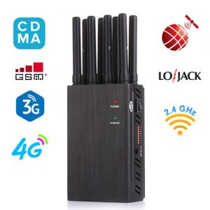
The company’s original target market was for defense, intelligence, and security application services. HawkEye is now looking into a new service that can locate GPS jammers.
“GPS glitches are on our product roadmap,” said Serafini, and the company hopes to be able to offer the service in about six months. “We have to evaluate the opportunity and develop a product.”
According to Logan Scott of LS Consulting, an expert in navigational and telecommunications signals, it’s entirely plausible that HawkEye’s satellites could locate GPS jammer. Scott said he was introduced to the technology at a presentation a few years ago, and while he didn’t do link analysis, he believes it has potential for such a skill. “If it’s a big jammer. Yeah, I could definitely see something like that – there are some nice things you can do.”
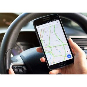
It might also be possible to gain insight into spoofing, albeit indirectly. AIS data has been used in this way by other organizations. For example, if the AIS location data indicates that ships are crossing dry land, it strongly suggests spoofing.
Hawkeye might be able to do something similar based on other modes of transport like trucks and trains. When publicly available location data is broadcast from a truck or other asset, the satellites can receive those signals directly, Serafini said. Alternatively, the company could use data from a third party. If the reported location and actual location do not match, it may be due to spoofing.
“We haven’t done that yet,” said Serafini, “but we would, and we believe there are commercially available databases that we could buy depending on which asset is to be tracked.”
HawkEye could even map such glitches over time. This could have been useful in the case of the truck driver whose GPS-interfering data protection device interfered with the ground-based augmentation system (GBAS) at Newark Liberty International Airport in Newark, New Jersey while driving past. The intermittent disturbances were a mystery at the time.
Das System kann möglicherweise auch genügend Daten sammeln, um festzustellen, ob Signale in Bändern in der Nähe der von GPS verwendeten Bänder GPS-Empfänger stören könnten. GPS-Benutzer haben diese Möglichkeit zuletzt aufgrund eines Vorschlags von Ligado Networks gesehen, das Satellitenfrequenzen verwenden möchte, die denen von GPS für einen terrestrischen Dienst benachbart sind. Mit den Signalfrequenz-, Leistungs- und Standortdaten des HawkEye-Systems könnte festgestellt werden, ob Ligado-Signale GPS-Geräte stören.
Eine der Herausforderungen dabei wäre laut Scott die Identifizierung eines bestimmten Senders, der Probleme verursachen könnte – insbesondere, wenn dieser Sender Teil eines Netzwerks mit anderen Sendern in der Nähe ist. Dies wird durch die Tatsache weiter erschwert, dass Kommunikationssender den größten Teil ihrer Leistung auf den Boden richten.
“Ich möchte nicht unmöglich sagen”, sagte Scott. “Ich möchte nicht verkürzen, was diese Jungs können. Sie sind eine sehr fähige Gruppe. Gleichzeitig versuche ich, bei meiner Einschätzung vorsichtig zu sein. ”
HawkEye beschäftigt sich noch mit seiner Analyse. Es ist noch zu früh, um weitere Einzelheiten über das Potenzial einer solchen Fähigkeit zu erfahren.
Scott schlug vor, dass HawkEye möglicherweise eine Wärmekarte erstellen kann, die Signale und ihre Leistung an verschiedenen geografischen Standorten zeigt. “Die Heatmap zeigt an, ob in diesem Bereich Probleme zu erwarten sind oder nicht.”
Serafini sagte, dass sie bereits einen solchen Service haben.
“Eines der Produkte, die wir heute anbieten, ist RFMosaic, das einen bestimmten geografischen Ort sowie einen bestimmten Zeit- und Frequenzbereich untersucht und die interessierenden Signale abbildet, die wir sehen – die spektrale Energie in diesem Bereich.”
RFMosaic enthält Funktionen, mit denen sich Änderungen der HF-Aktivität im Laufe der Zeit identifizieren und potenzielle Störquellen identifizieren lassen, so die Website des Unternehmens.